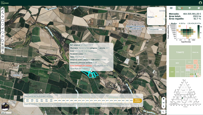
Hareas Agroinsights transforms complex geospatial data, primarily from satellites and public sources, into clear and accessible insights for the rural sector. Its mission is to democratize this information to improve decision-making in the use and exploitation of rural land, making it usable for farmers, investors, and companies without the need for technical expertise.
Its proprietary technology takes the form of an intuitive web platform that centralizes and processes data on soil, climate, water, and productivity. The platform offers advanced tools for valuing land contextually, customized solutions for companies, and facilitates the integration of its data via APIs into other tools. All of this with the aim of detecting opportunities, analyzing risks, and planning investments effectively.
Driven by a clear social and territorial vocation, Hareas Agroinsights seeks to help make the rural sector more competitive, resilient, and attractive. Its goal is to empower its users by giving them the ability to integrate territorial intelligence into their value proposition and laying the groundwork for a more sustainable primary sector that is prepared for the future.


José Bayón, dir. public affairs GDELS

Gonzalo León, executive committee Innovative Companies Forum


Micaela Martelli, Director of Sectorial Solutions Telefónica


Blanca Caballero, CEO Nanological

Carolina Gago, COO IOT Lenses


Amalio Garrido, CEO Drage&Mate

Mª Jesús Romero, dir. of economy and industry, Madrid City Council

Marina Villegas, General Director of Research and Technological Innovation Community of Madrid


Mª Inmaculada López, Director Compluemprende


Eduardo Díaz, Director of EBT Office Fund. Madri+d

Luis Baratas, head of entrepreneurship sector, ICEX